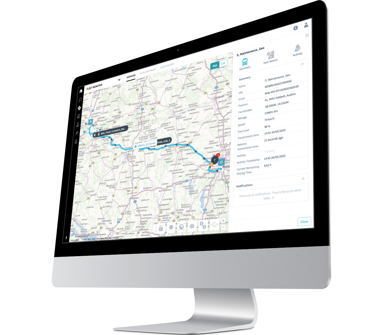
The digital compass for your fleet
Have you ever thought about training your drivers to adopt a highly economical driving style and optimise routes? Thanks to the journey history, which stores your data on the RIO platform for 25 months, you can retrospectively identify ways in which your drivers could optimise their mileage. Have your drivers take alternative routes and find out which one is the best straight away. What’s more, with Geo, you will have a built-in route planning function and an overview of all vehicle locations. You can rely on these functions to calculate whether a new order is worthwhile for you. The new position sharing function also provides maximum transparency: this allows you to share location data for vehicles and vehicle groups with your customers easily in the form of a link. In this respect, our Geo service enables you to get the most out of your resources.
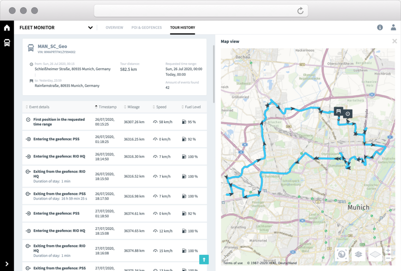
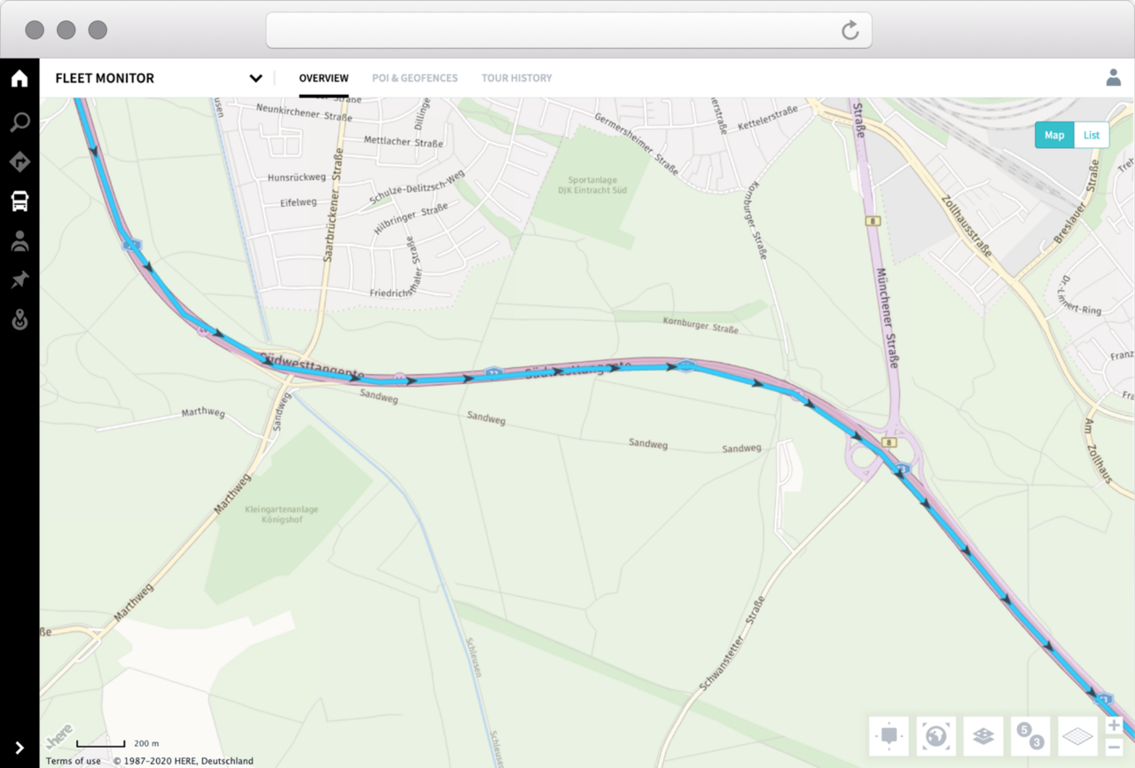
Journey history
The journey history provides you with an overview of all of the relevant data from the last few months. You can use this review not only to meet your obligation to provide evidence to the customer, but also to train your drivers to take different routes. The history has been expanded to 25 months to provide you with the greatest possible benefit. In the journey history, you can view key events such as the initial and final location of the vehicle, geofence entry and exit points, border crossings, driver changes and much more.
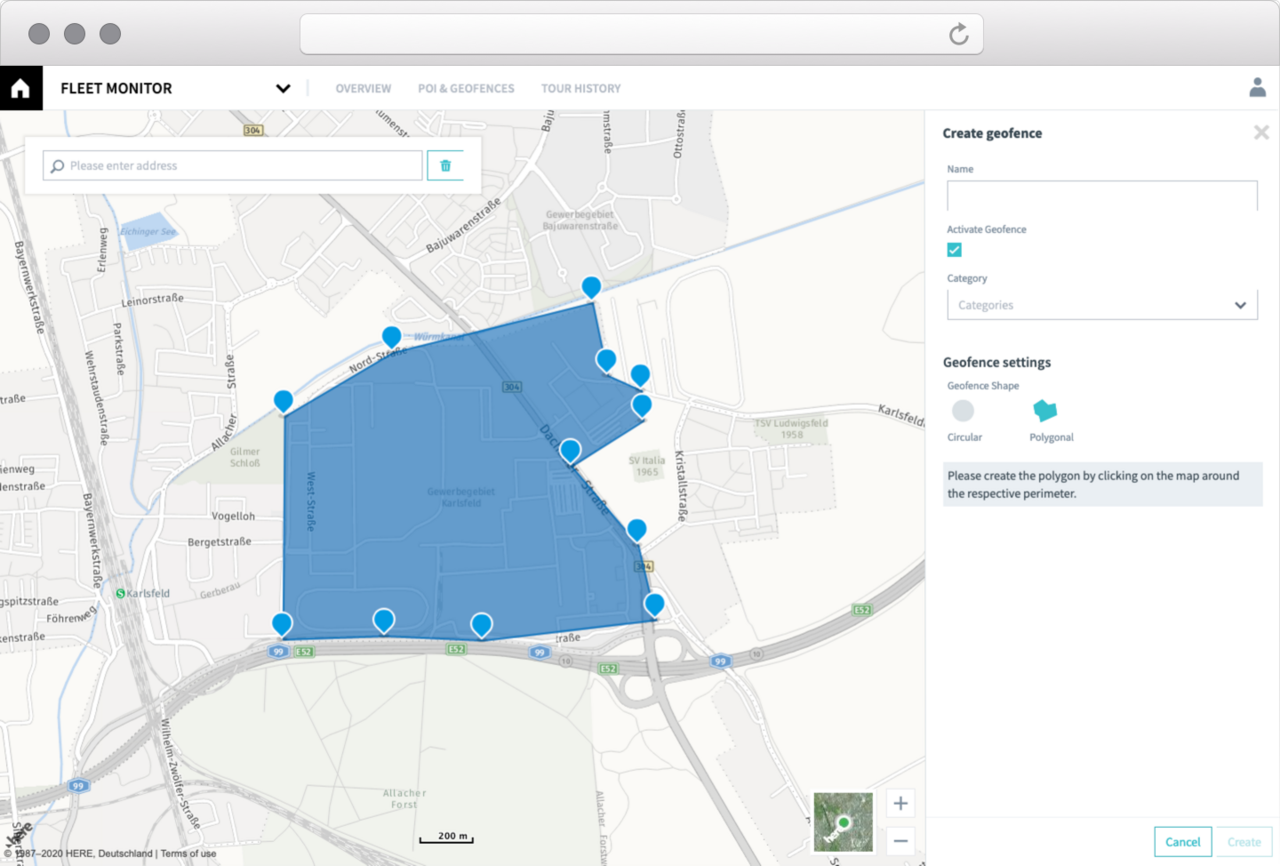
POIs and geofences
Generally speaking, other telematics systems only feature standardised maps. With Geo, you can create your own customised map. Create your own points of interest that are tailored to your drivers and routes. You can also keep track of things by saving places that are of importance to you on your map and adding places to it. MAN workshops and service partners are already saved as POIs on the map. What’s more, you can define and create your own round and polygonal geofences. Thanks to the direct notification system this provides and the vehicle filter function that is displayed in a geofence detail window on the map, you will have both a greater degree of control and more clarity.
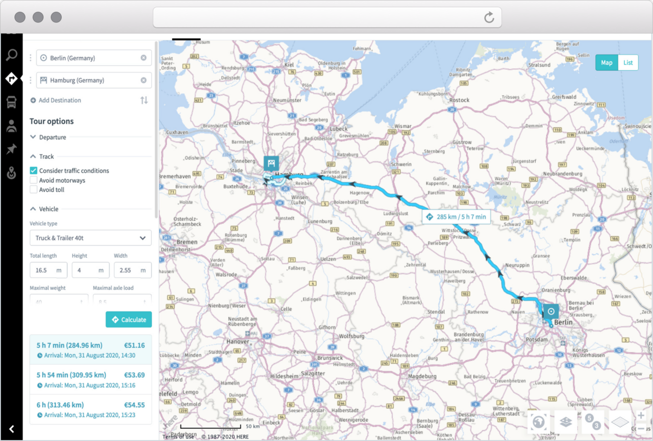
Route planning
Still planning your routes in the traditional way? Not only does digitisation of route planning make things a lot easier, it is also beneficial in many other respects. In addition to the basic functions of entering the starting point/destination in the address search function or right-clicking on a map/vehicle, interim destinations can be added, thus optimising the route for commercial success. You can rely on the route planning function to calculate whether a particular journey is worthwhile for you. You will be provided with up to three different alternative routes that take the latest traffic disruption into account. What’s more, the toll charges for your journey will be calculated automatically while you are working out the best route.
Position sharing
What would you say if your customer could easily see where their shipment is and even track it? There would no longer be any need for those impatient phone calls. With Geo, you can share location data for vehicles easily in the form of a link. The recipients of the link can see the shared location data on the map without having to have a RIO account. Despite the fact you are sharing this data with customers, you will continue to have full control over matters and will be able to configure exactly how the location data is shared and delete it at any time. You won’t have to worry about data protection either: highly sensitive information such as the driver’s name is not shared. By using our Geo service for location sharing, you can provide your customers with full transparency.

Shortened GPS tracking interval
In order to ensure optimal scheduling of your vehicle fleet, it is important to keep track of the exact vehicle location. In the event of increased traffic volumes or short-term road closures, you can quickly intervene and plan an alternative route to ensure on-time and reliable delivery.